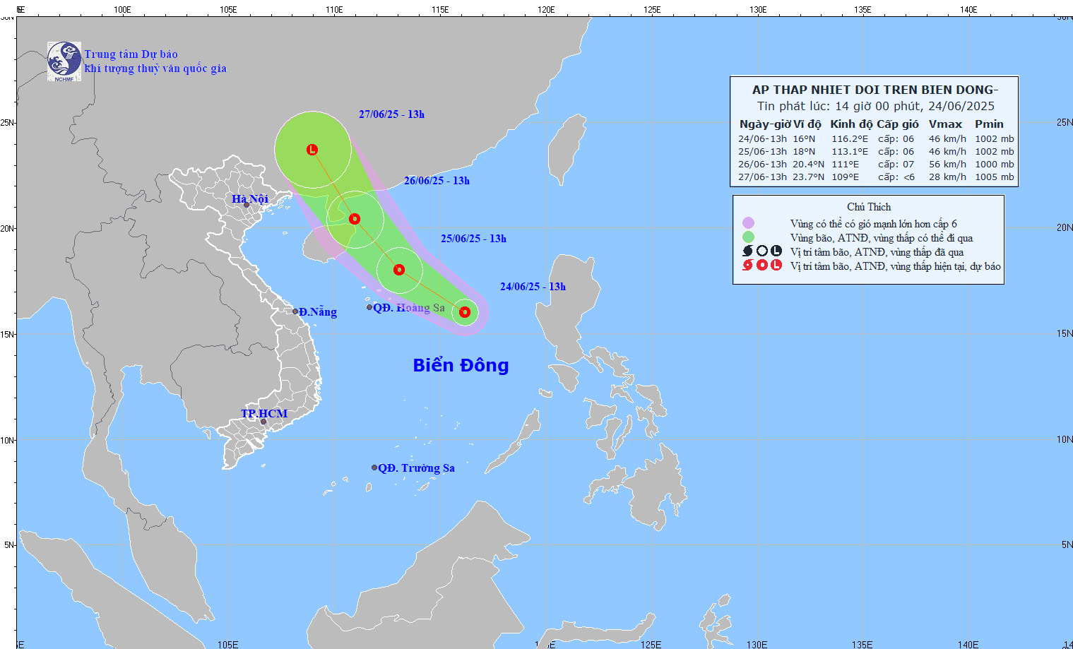
This afternoon (June 24), a low-pressure area over the northern East Sea strengthened into a tropical depression, causing thunderstorms and strong winds of level 6-7, gusting up to level 9, in the northern East Sea region (including the Hoang Sa Archipelago).

Mr. Mai Van Khiem, Director of the National Center for Hydro-Meteorological Forecasting, stated that by noon today, the low-pressure area in the northern East Sea had intensified into a tropical depression.
At 1:00 PM, the center of the tropical depression was located at approximately 16.0°N latitude and 116.2°E longitude, about 500 kilometers east-southeast of the Hoang Sa Archipelago. The strongest winds near the center reached level 6 (39-49 km/h), with gusts at level 8. The system was moving northwest at about 15 km/h.
According to Mr. Khiem, over the next 24 hours, the tropical depression is expected to continue moving northwest at a speed of 15-20 km/h. By 1:00 PM tomorrow (June 25), the center of the depression will be about 240 kilometers northeast of the Hoang Sa Archipelago, maintaining wind strength at level 6, gusting to level 8.
The depression is expected to maintain its direction and speed, with potential strengthening. By 1:00 PM on June 26, its center will be located over the northeastern waters of Hainan Island (China), with an intensity of level 6-7, gusting to level 9.
Between 48 and 72 hours from now, the system is forecast to continue moving northwest at 15-20 km/h while gradually weakening in intensity.
Due to the influence of the tropical depression, the northern East Sea region (including the Hoang Sa Archipelago) will experience thunderstorms and strong winds at level 6-7, gusting to level 9, with rough seas and waves of 2-4 meters high.
Vessels operating in the affected areas are at risk of being impacted by thunderstorms, waterspouts, strong winds, and large waves.
Bao Anh