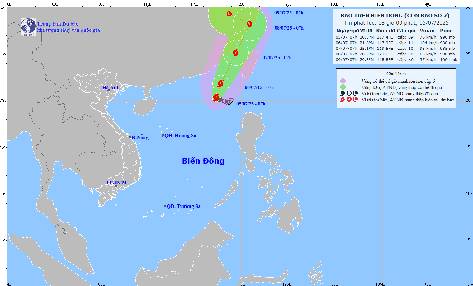
As of 7 a.m. on July 5, the storm's center was located at approximately 20.3 degrees North latitude and 117.4 degrees East longitude.
The strongest winds near the storm’s center were between level 8 and 9 (62-88 km/h), with gusts up to level 11. The storm was moving slowly toward the west-northwest at a speed of 5-10 km/h.
Forecasts indicate that in the next 24 hours, Storm No. 2 will shift direction slightly northward, still traveling at 5-10 km/h, and is expected to strengthen.
By 7 a.m. on July 6, it will remain over the northeast East Sea with wind speeds increasing to level 10-11 and gusts reaching level 13.
In the subsequent 24 hours, the storm is predicted to change course toward the north-northeast at about 15 km/h. By 7 a.m. on July 7, it will be situated offshore of Fujian Province, China, with winds at level 10 and gusts at level 12.
After that, it will continue moving in the same direction, making landfall in Zhejiang Province, China, where it will gradually weaken.
Between 72 and 96 hours from now, the storm is forecast to move west-northwest at approximately 10 km/h, weakening further into a low-pressure area.
Forecast impacts of Storm No. 2:
Strong winds and high waves are expected. In the northeast East Sea, stormy weather with winds at levels 7-8 and areas near the center experiencing levels 9-11 with gusts up to 13 will cause extremely rough seas. Wave heights are predicted to reach 4-6 meters.
In addition, the central East Sea and waters from Khanh Hoa to Ca Mau will experience southwest winds at level 5, sometimes level 6, with gusts of level 7-8 and wave heights between 2-4 meters, causing significant sea disturbances.
Vessels operating in these hazardous zones are at high risk of encountering thunderstorms, waterspouts, strong winds, and large waves.
Bao Anh
