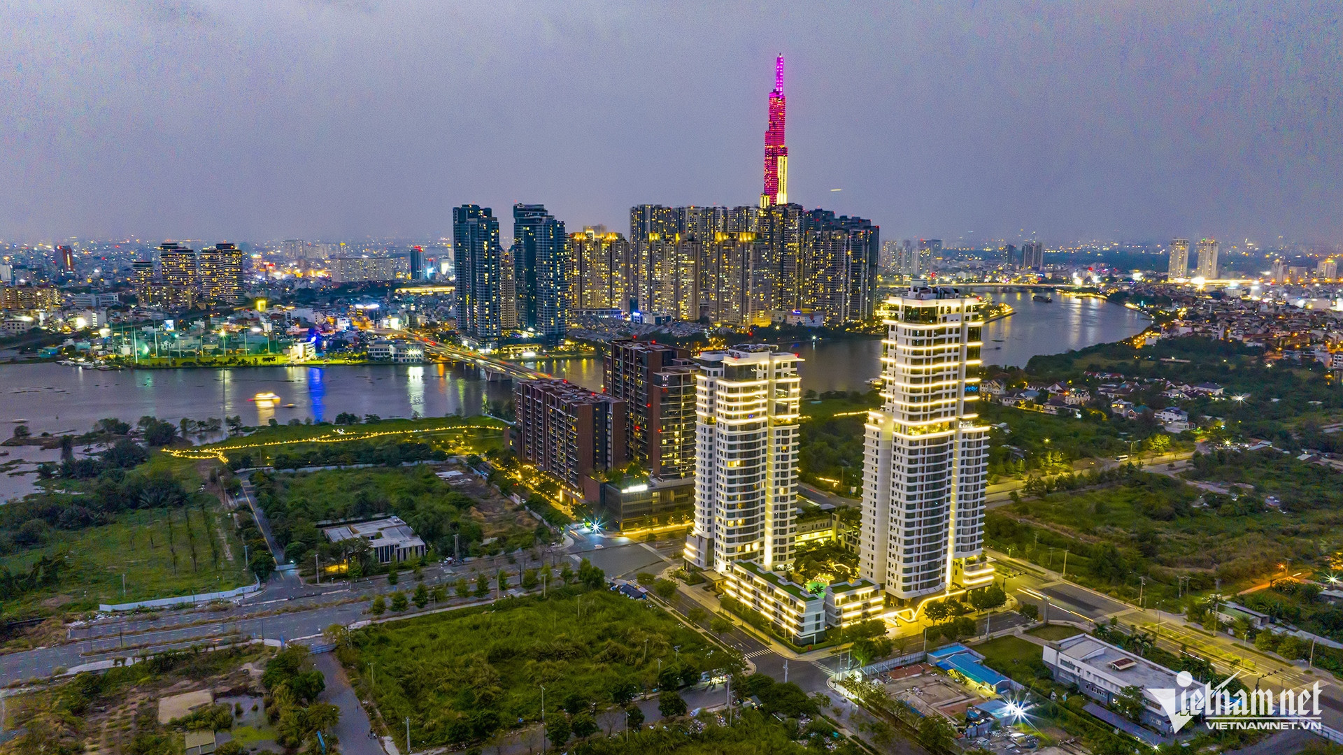
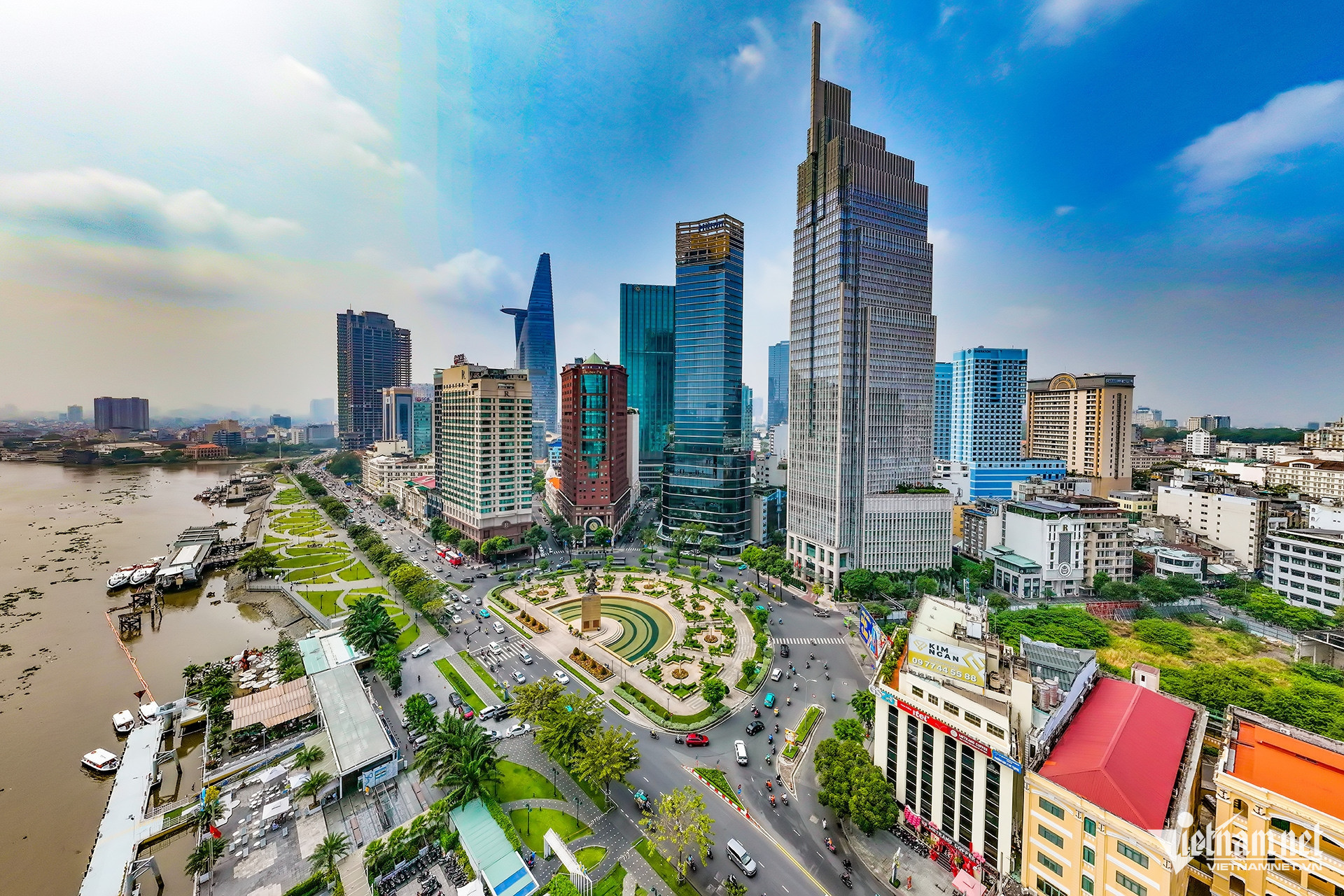
Fifty years after national reunification, Ho Chi Minh City has transformed from a city scarred by war into the country’s most dynamic economic hub, adorned with a modern skyline. Innovation now courses through every facet of urban life - from infrastructure and technology to how people live, work, and connect with the world.
However, rapid development has brought complex challenges: population pressure, overloaded infrastructure, climate change, and widening gaps between the urban core and outlying areas.
As the Party and State push forward major initiatives to build a stronger nation, Ho Chi Minh City - Vietnam’s economic engine - must urgently tackle its own challenges with a long-term, practical, and comprehensive vision.
VietNamNet presents the series “Ho Chi Minh City: Removing bottlenecks to rise into the future,” featuring insights and strategic advice from Vietnamese experts around the world. With a global perspective and heartfelt connection to the city's future, they all share the same aspiration: for Ho Chi Minh City to become a smart, livable, nature-friendly metropolis with a unique identity in the flow of globalization.
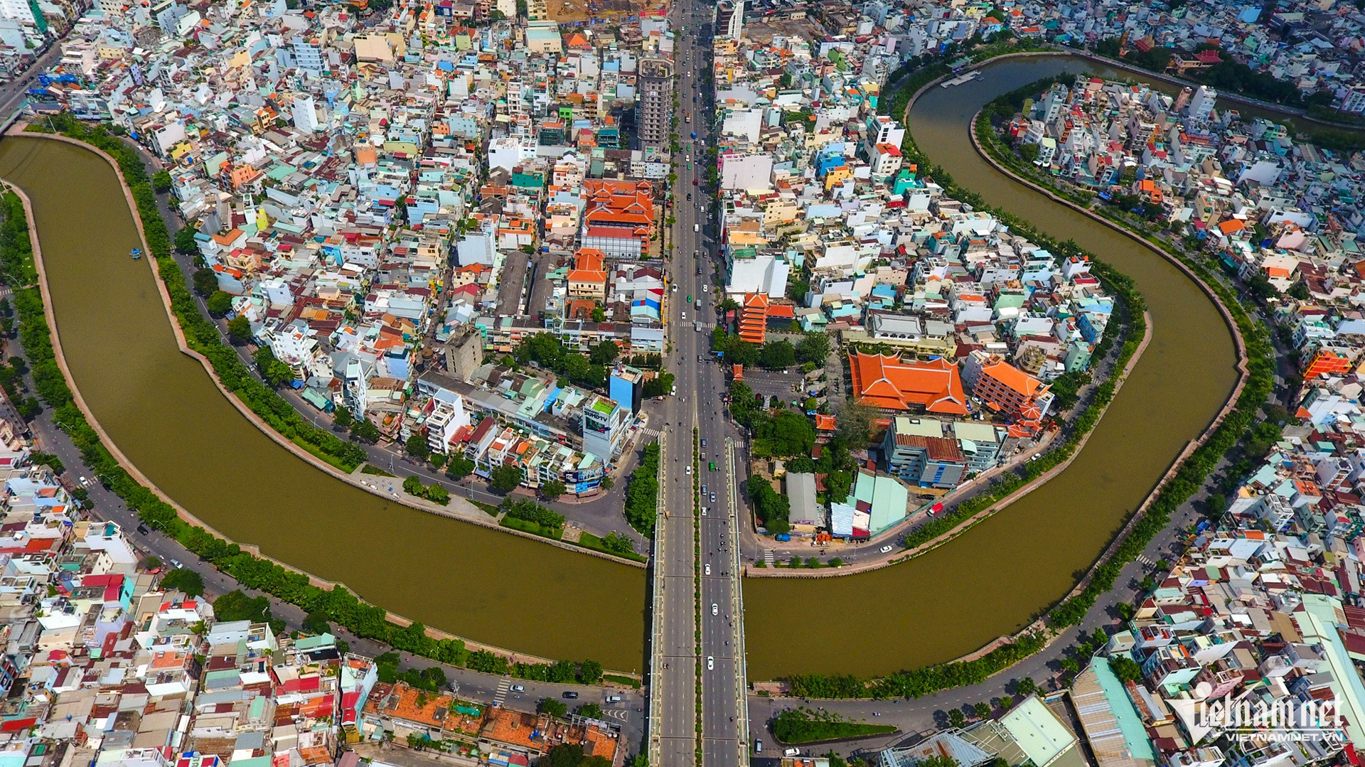
As Ho Chi Minh City aims to become a leading Asian destination by 2030, experts say the Saigon River must be at the heart of its 2021-2030 urban planning strategy.
Earlier this year, the city released its orientation plan for Saigon River development within its broader urban growth framework.
One key project is a 4-kilometer riverside road stretching from Ba Son Bridge to Binh Trieu Bridge, with an investment of over $134 million, set for completion between 2024 and 2030. Beyond that, experts are proposing a comprehensive plan to develop the full 80-kilometer stretch of the Saigon River that runs through the city.
Reviving a historic lifeline
Dr. Huynh Dat Vu Khoa, a senior advisor from the Norwegian Geotechnical Institute and member of the Saigon River corridor planning advisory group under AVSE Global, emphasized the importance of proper development.
Dr. Khoa stressed that successful planning must be based on long-term vision, consensus among government, experts, and the community, and international best practices that balance modernization with ecological preservation.
Inspired by the Seine in Paris and the Thames in London, he proposed creating riverside public spaces with pedestrian walkways, bike paths, parks, plazas, cafes, and open-air art exhibitions - allowing citizens and tourists to enjoy urban life along the river.
A second idea involves developing integrated urban areas - including housing, commerce, and office space - with decreasing building heights and densities as they approach the riverbank (within 20, 50, and 100 meters depending on the zone). This approach would create a spacious, open riverside atmosphere and avoid forming a "concrete wall" along the river, similar to London's successful model.
Water transport should also be prioritized. “The Saigon River can become a vital transport axis, with ferries, tourist boats, and water taxis operating much like those on the Seine,” Dr. Khoa noted. This would ease road traffic and strengthen urban connectivity.
Another key recommendation from AVSE is tapping into the river’s cultural and historical depth. Landmarks like Nha Rong Wharf and Bach Dang Wharf should be celebrated to strengthen the river’s identity for locals and visitors.
"Ho Chi Minh City should also create iconic landmarks, much like the Eiffel Tower in Paris or the London Eye," Dr. Khoa proposed.
The idea of a floating garden island near District 1 was also discussed. It would serve not only as a public space but also connect the river’s two banks and become a unique urban highlight. Though further studies are needed to assess environmental impacts, similar models have succeeded in countries like South Korea.
Modern development with a focus on sustainability
Urban spaces along the river must not be dominated by concrete and glass. AVSE experts emphasized the need for green corridors and natural wetlands to absorb rainwater, reduce flooding, and protect ecosystems.
“We can learn from how the Thames manages water smartly,” Dr. Khoa said, referencing systems like rain gardens that quickly absorb runoff during storms.
For embankments, instead of harsh concrete structures, the city could adopt methods used along the Danube, utilizing natural stones and aquatic plants to preserve river flow and create scenic ecosystems.
The Saigon River is not merely a physical flow but a cultural, historical, economic, and emotional one. Thoughtful, nature-respecting planning that involves the community and learns from global models can turn the river into a powerful engine for Ho Chi Minh City's future growth.
Flood control cannot be separated from river planning
Dr. Bui Man, senior engineer and Director of GTC Soil Analysis Services Laboratory in Dubai, agreed with Dr. Khoa. He stressed that Saigon River planning must be based on fundamental principles: harmony with nature, people-centered design, holistic water resource management, and cultural preservation.
Dr. Man urged the city to view its rivers and canals as the "soul of the city" - both a heritage to protect and a strategic brand asset for sustainable exploitation.
Flood control must be an integral part of river planning. Given the city’s dense waterways, flood mitigation cannot rely solely on traditional drainage systems. The fundamental solution is to "give space back to water" - expanding water surfaces alongside effective cross-drain systems.
Unlike conventional longitudinal drains, cross-drains are short pipes that discharge directly into canals and retention ponds, significantly reducing water retention time during heavy rains.
Thus, the city must expedite the construction of interconnected retention ponds to enhance stormwater management capacity.
Increasing water storage volume - from households to urban planning

There are several ways to increase water storage capacity: regular dredging of the Saigon River and major canals, widening channels, deepening flows, building vertical embankments, and upgrading the existing underground drainage system with larger pipes.
At the household level, citizens can contribute by installing rainwater tanks, helping to ease pressure on the public drainage network.
Deploying pumps at low-lying areas is essential - but this must be paired with sufficient reservoirs and canals to ensure effective drainage during floods.
However, Dr. Man cautioned that rapid drainage solutions are only effective if supported by a strong retention system.
“Flood mitigation must be a top priority,” Dr. Man emphasized. “Flooding severely impacts tourism, business activities, and citizens' quality of life. For instance, losing just one hour of work due to flooding could cut daily GDP by up to 10%.”
Following the river to the sea
For Saigon River transport planning, Dr. Man proposed building riverside boulevards and metro lines that flow downstream, continuing along the Soai Rap and Long Tau Rivers toward the sea.
He argued that this should become one of the city's strategic transportation backbones in the 21st century. The city's future development space and economy will shift toward the sea, aligning with blue economy strategies.
These riverside corridors would also create distinctive riverfront spaces, boosting marine tourism, cultural zones, and high-end real estate development.
Nguyen Thao