A rare tropical storm formed in the East Sea in mid-June, bringing torrential rains not aligned with its center. Storm Wutip, Vietnam’s first named storm of 2025, did not make landfall, but its circulation unleashed massive rainfall and flooding from June 11 to 13 across central and Central Highlands provinces.
Experts say Wutip's movement and its effect on central Vietnam defied conventional patterns.
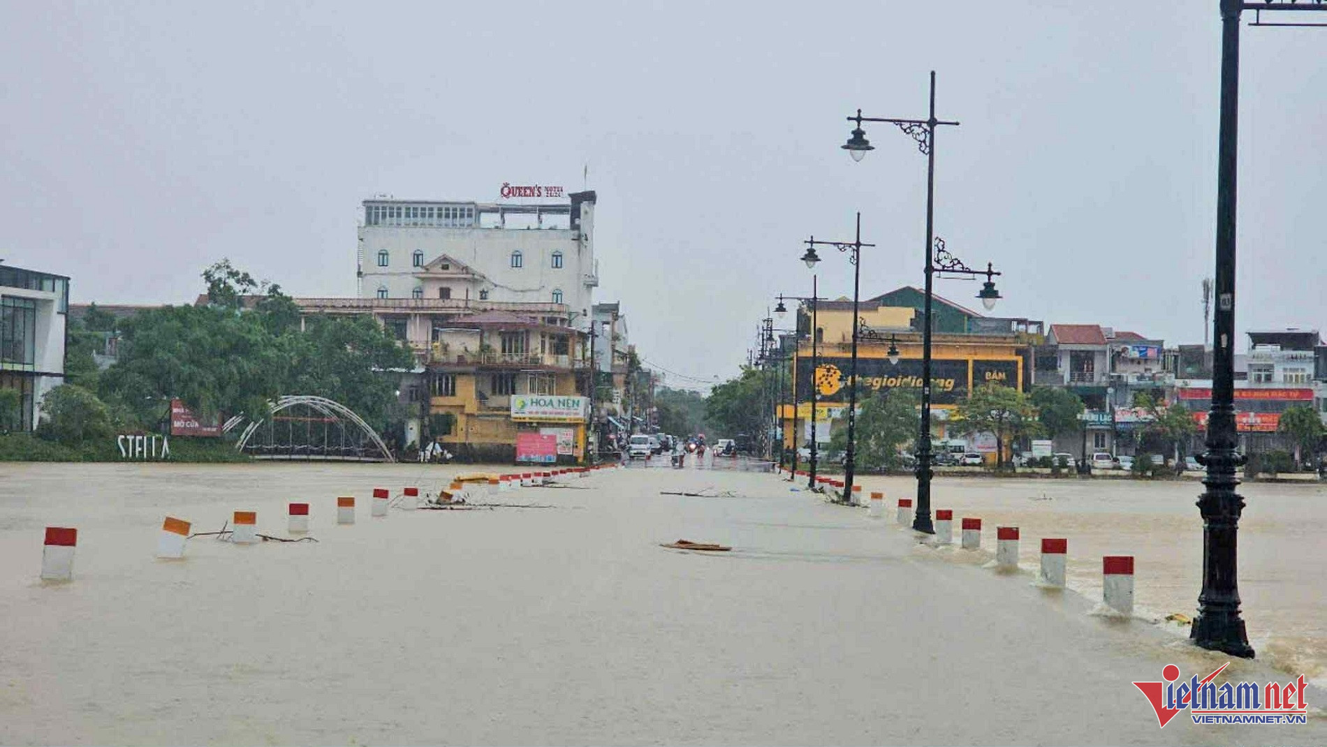
Mai Van Khiem, Director of the National Center for Hydro-Meteorological Forecasting, described the phenomena as unusually severe. Central provinces like Quang Tri and Da Nang recorded rainfall totals between 300mm and 650mm in just three days, with Nam Dong (Hue) reaching a staggering 768mm - 559mm of which fell on June 12 alone, an extraordinary level for the region and time of year.
Khiem noted that 32 automatic rain gauges recorded 6-hour rainfall totals exceeding 200mm, especially in Hue and Da Nang. The highest single-day rainfall was at Bach Ma Station (Phu Loc District), recording 884.2mm on June 12.
River levels on the Kien Giang, Thach Han, Bo, and Vu Gia rivers reached peak levels not seen in the past 30 years, marking one of the most significant June flood events in central Vietnam.
Dr. Nguyen Ngoc Huy, a climate and disaster risk expert, emphasized how anomalous this event was. “In mid-June - close to the summer solstice - central Vietnam typically braces for heatwaves, not storms. If any typhoons form, they usually head north, toward China or Japan,” he said.
But this year, "nothing followed the usual script." A tropical storm formed mid-June in the East Sea, but with rainfall concentrated far from the storm center.
“This was especially unusual because the storm center and rain center were in entirely different places. Most of the rain was pushed to the storm's left flank, hitting central Vietnam directly,” Huy explained.
The rainfall affected provinces from Quang Nam to Quang Binh, with the Bach Ma station logging over 900mm in a single day - unprecedented for June.
Storm Wutip’s left-side circulation extended across central Vietnam, bringing flash floods and unexpected inundations from highlands to lowlands.
Experts attribute these abnormalities to climate change, predicting such extreme weather will become more frequent.
More storms possible within a month
Dr. Hoang Phuc Lam, Deputy Director of the forecasting center, stated that 11–13 storms are expected in the East Sea in 2025, with 5–6 potentially making landfall in Vietnam. Between June 11 and July 10, 1–2 storms or tropical depressions may impact Vietnam directly.
Rainfall nationwide is projected to match or slightly exceed seasonal averages. In the Red River Delta and North Central Region, rainfall may be 10–25% above average. Central provinces may see levels 50–100% higher than normal.
Widespread rainstorms are likely in northern regions, while the Central Highlands and southern provinces will face frequent thunderstorms and heavy rain due to strong southwest monsoons. Meanwhile, heatwaves will persist in northern and central regions, including potentially extreme events.
Across the country, hazardous weather - lightning, hail, strong winds - is expected to continue.
As of 6:30 PM on June 13, the Disaster and Dike Management Authority reported severe flood damage: two deaths in Quang Tri, four people swept away in Quang Binh, and 28 houses damaged (27 in Ha Tinh, one in Quang Tri).
Flooding affected 3,575 homes (Quang Tri 2,770, Da Nang 80, Quang Nam 725), and eight boats were sunk or damaged. Over 88,000 hectares of rice and crops were flooded across Ha Tinh, Quang Binh, Quang Tri, Hue, Quang Nam, and Da Nang, along with 1,800 hectares of aquaculture farms.
Multiple roads, highways, and rural routes were submerged and cut off.
Bao Anh