On July 2, 1976, the city of Saigon - Gia Dinh was officially honored with a new name: Ho Chi Minh City, in tribute to the nation's beloved leader. Since then, the city has grown through historical milestones, with numerous iconic structures standing as enduring witnesses to its transformation.
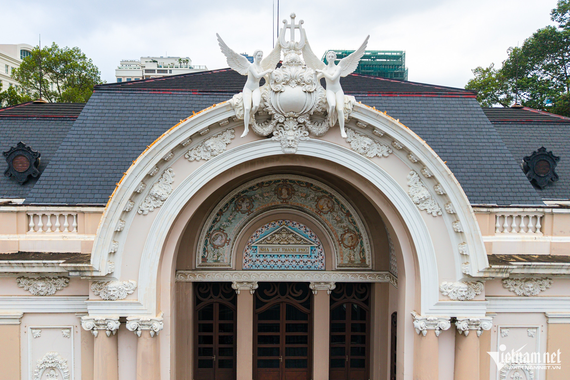
Landmarks like the Ho Chi Minh City People’s Committee headquarters, the Central Post Office, and Notre-Dame Cathedral Basilica have become timeless symbols.
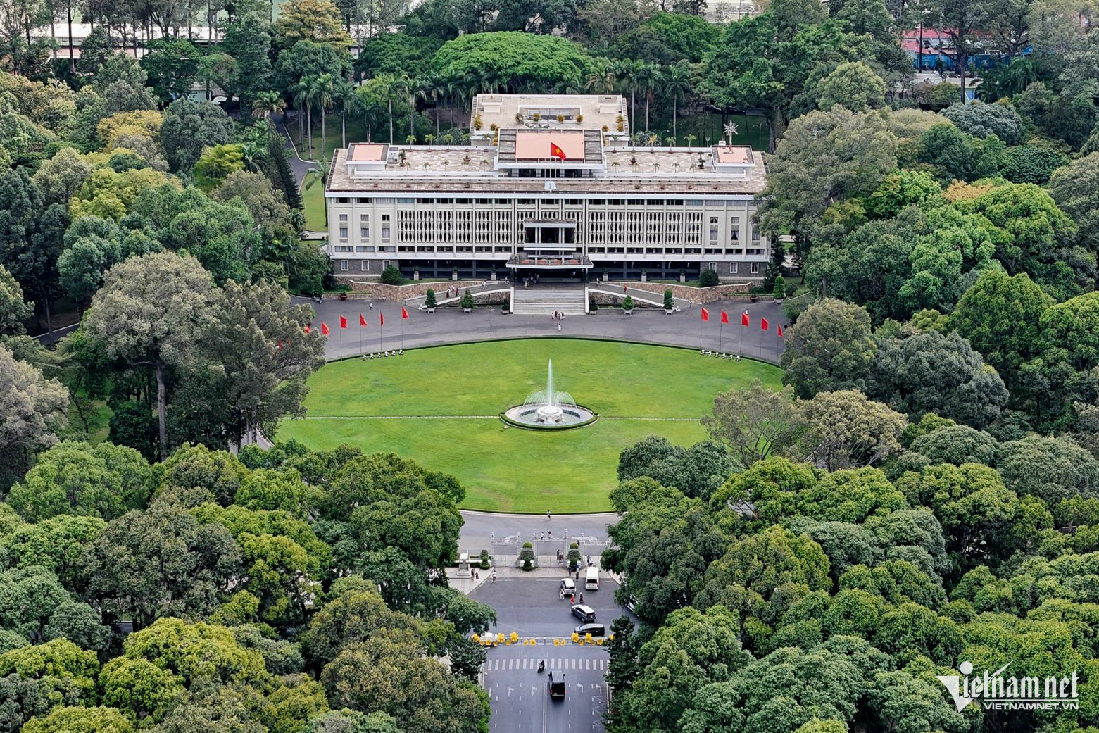
The Independence Palace, formerly known as the Reunification Hall, is one of Ho Chi Minh City’s most historic sites. It bore witness to the defining moment of April 30, 1975, when the Ho Chi Minh Campaign marked the culmination of the Spring Offensive and the end of the Vietnam War.
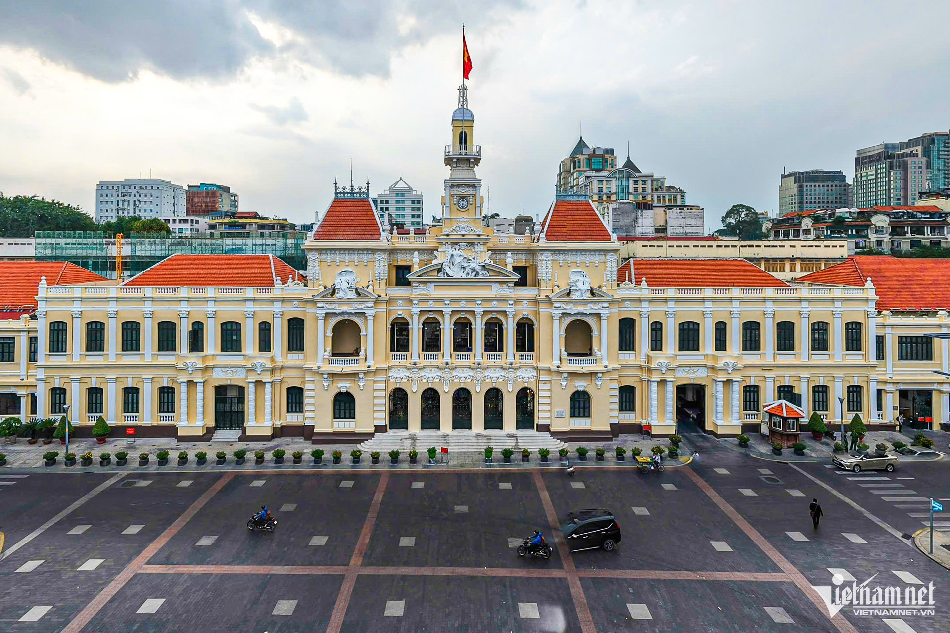
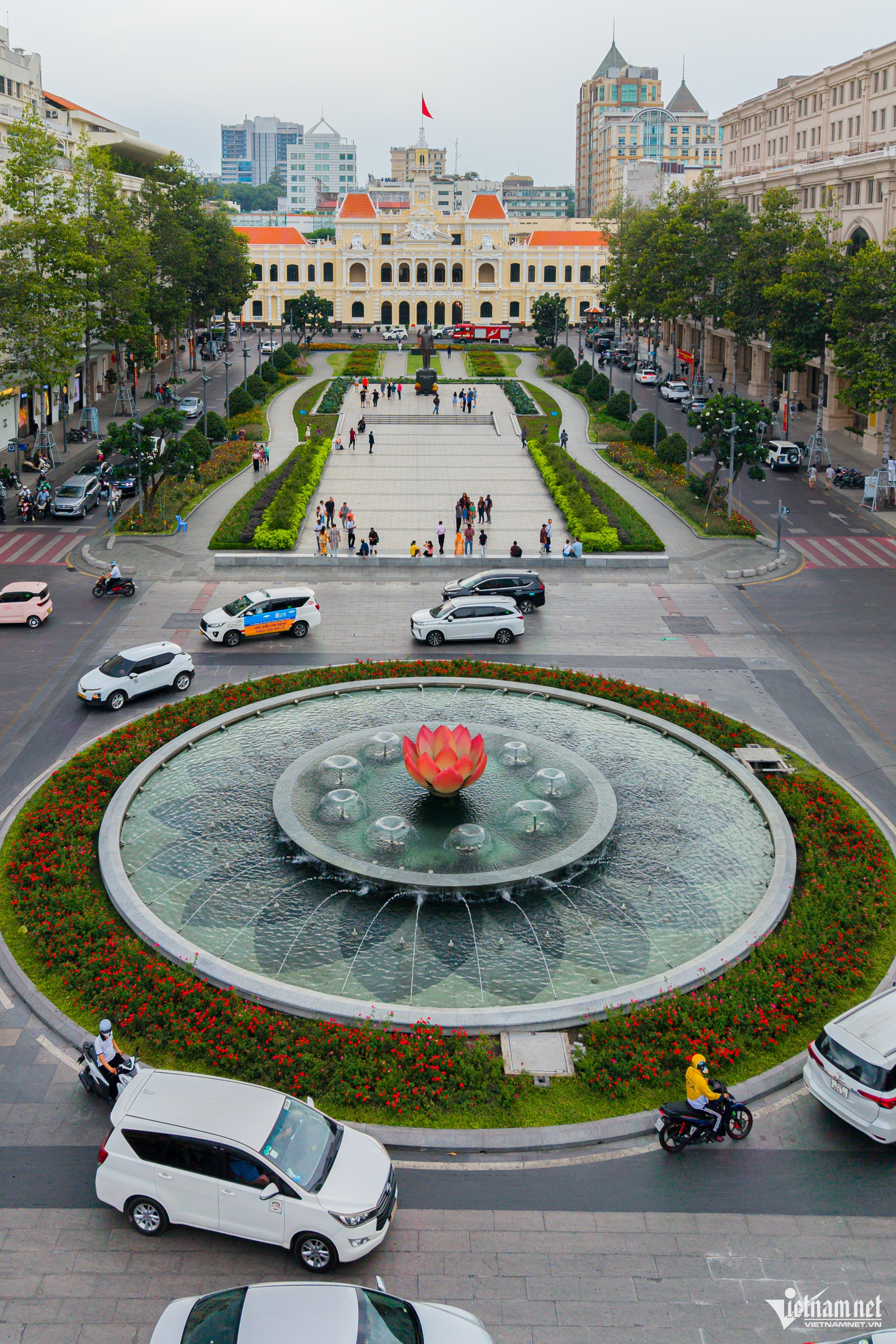
The headquarters of the People's Council and People’s Committee of Ho Chi Minh City, located on Le Thanh Ton Street, is a magnificent French colonial structure built in the Baroque style. Adorned with intricate carvings and a dignified façade, it has become an architectural icon of the city.
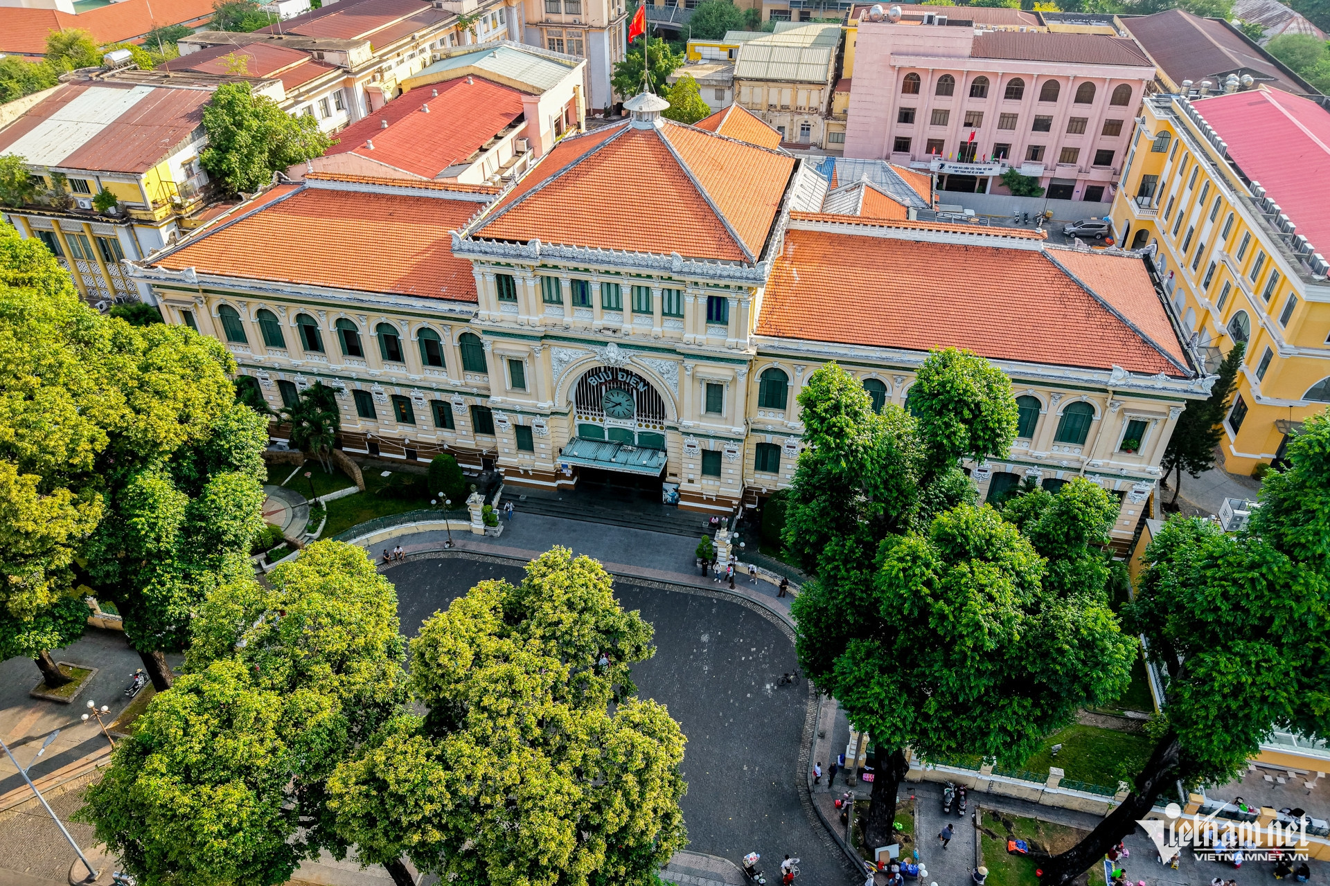
The Central Post Office, located beside Notre-Dame Cathedral, is a prominent example of French colonial architecture. Designed by architect Villedieu and his assistant Foulhoux, the building features a grand vaulted ceiling, arched windows, classic tiled floors, and two historic maps painted on the walls at the main entrance.
Nha Rong Wharf is a historical monument that marks the starting point of President Ho Chi Minh's journey to find a path to national salvation.
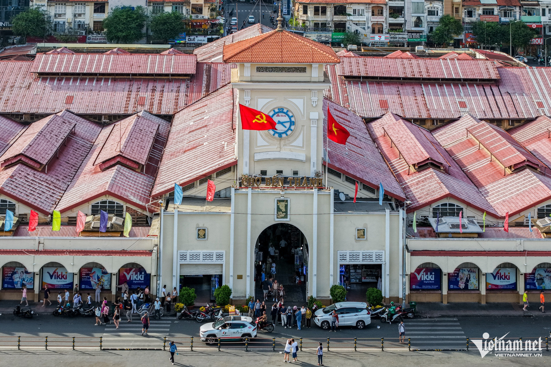
Built in 1914, Ben Thanh Market is not only a trading hub but also a cultural relic of the city. It has witnessed the city's trials and triumphs and remains a vibrant symbol of Ho Chi Minh City's resilience and transformation.
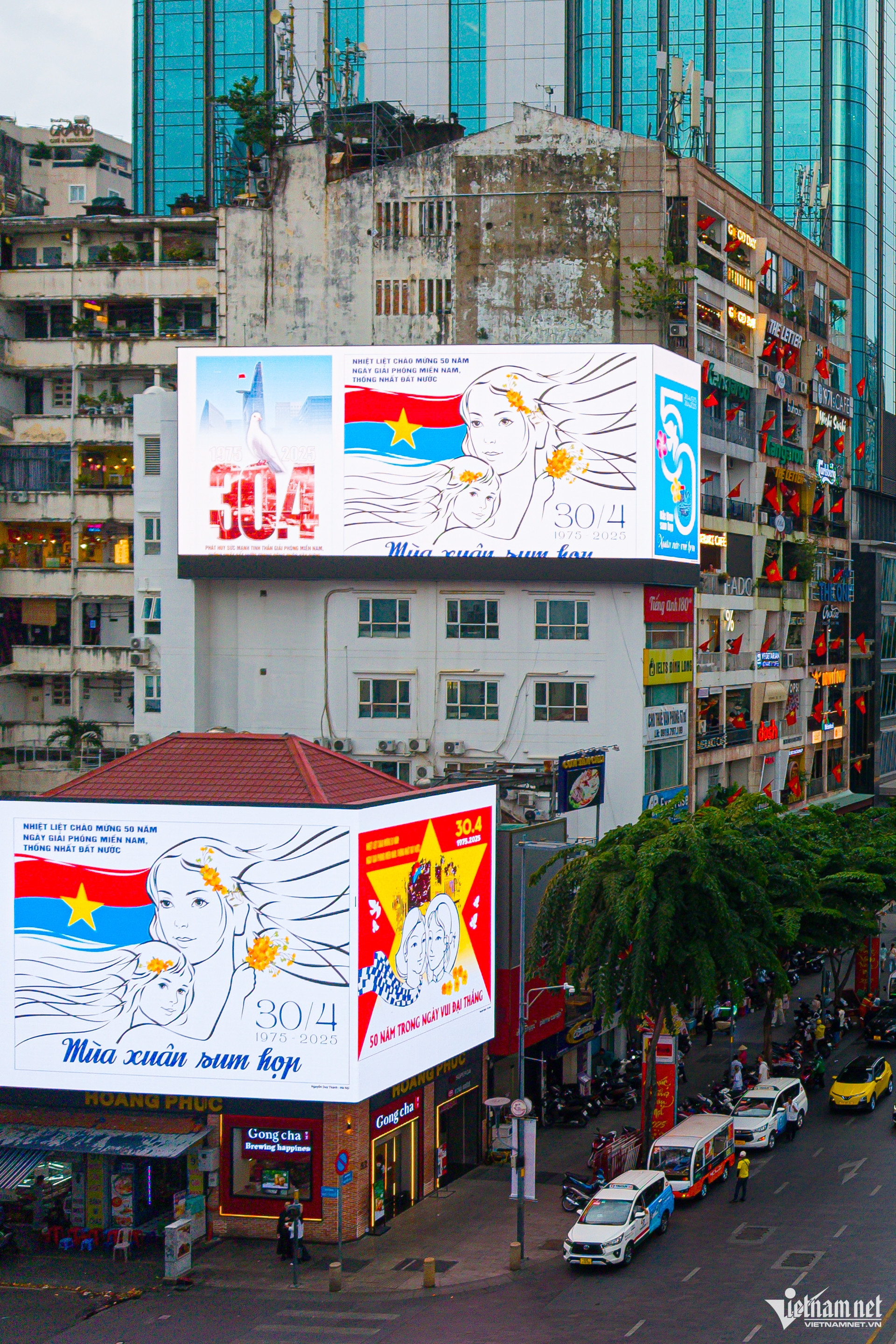
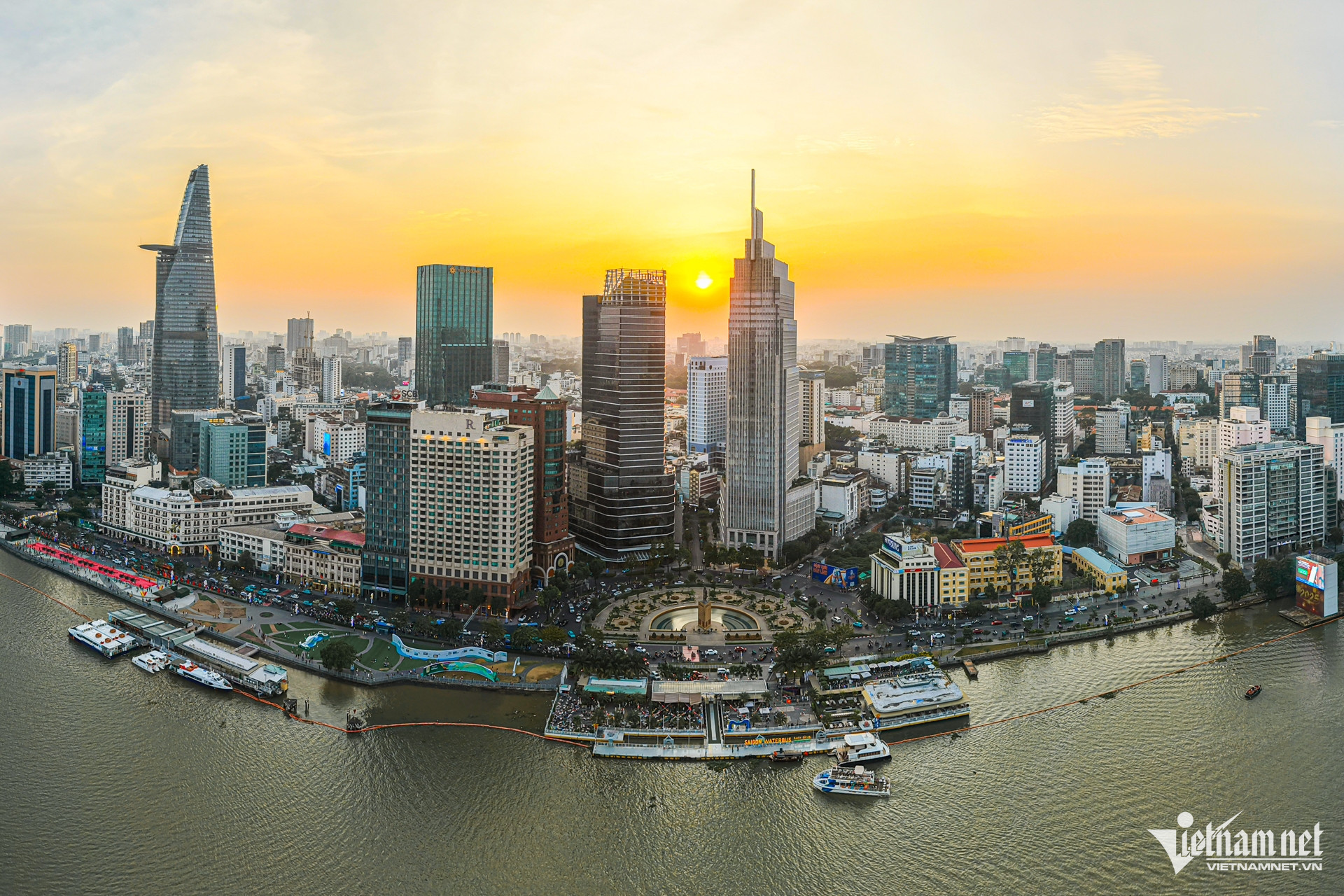
In these historic April days, Ho Chi Minh City buzzes more than ever, its streets adorned with bright flags and flowers celebrating national reunification.
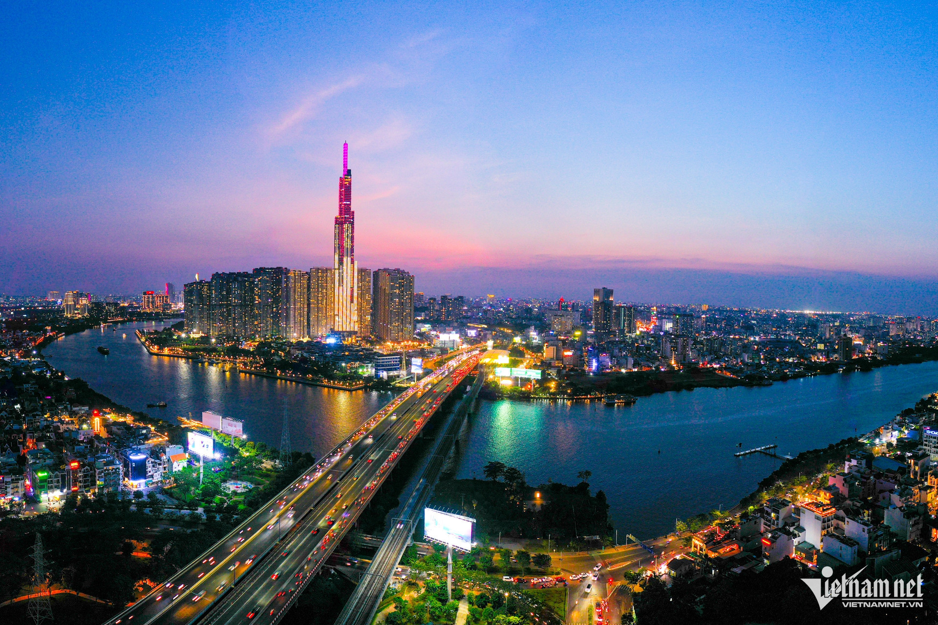
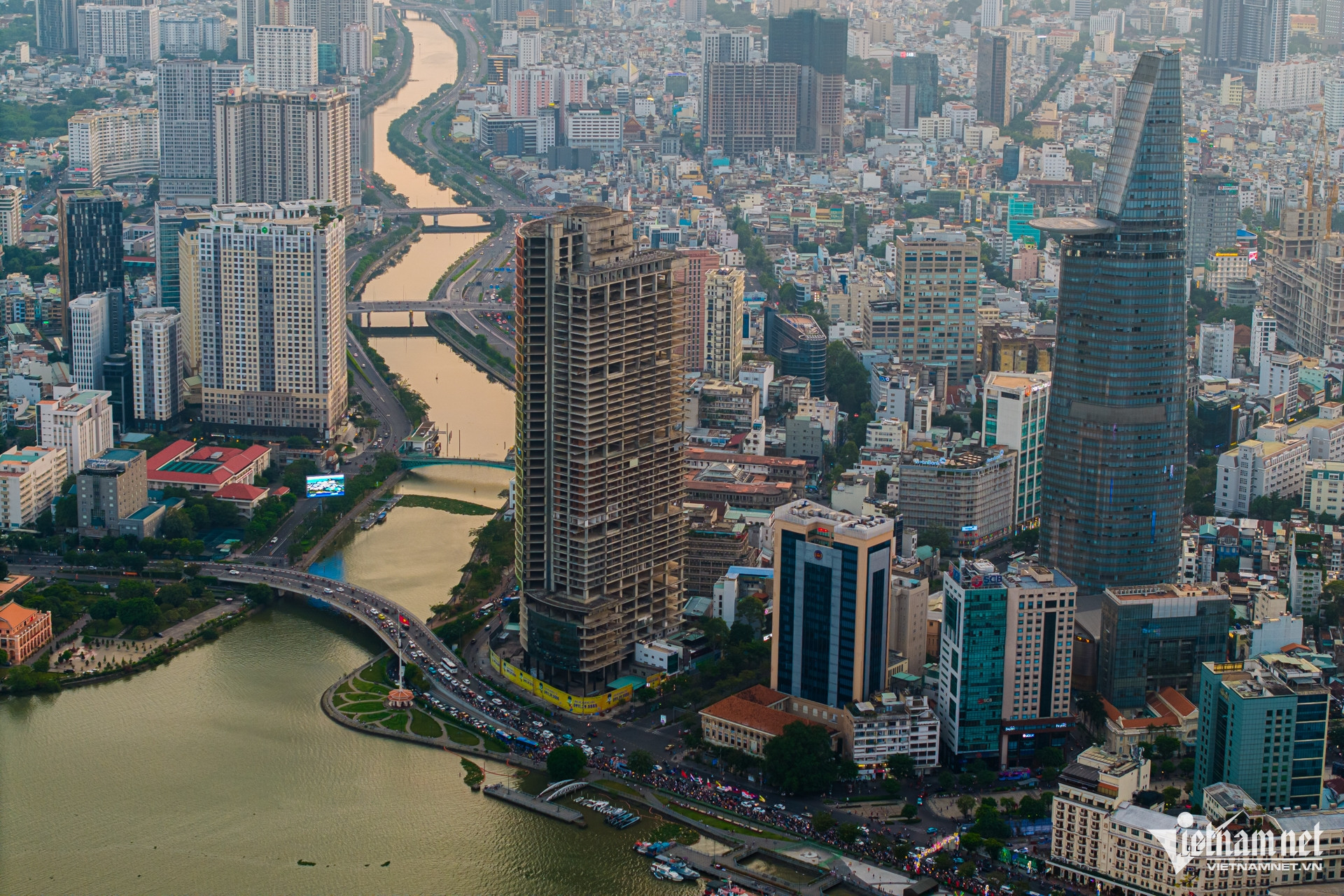
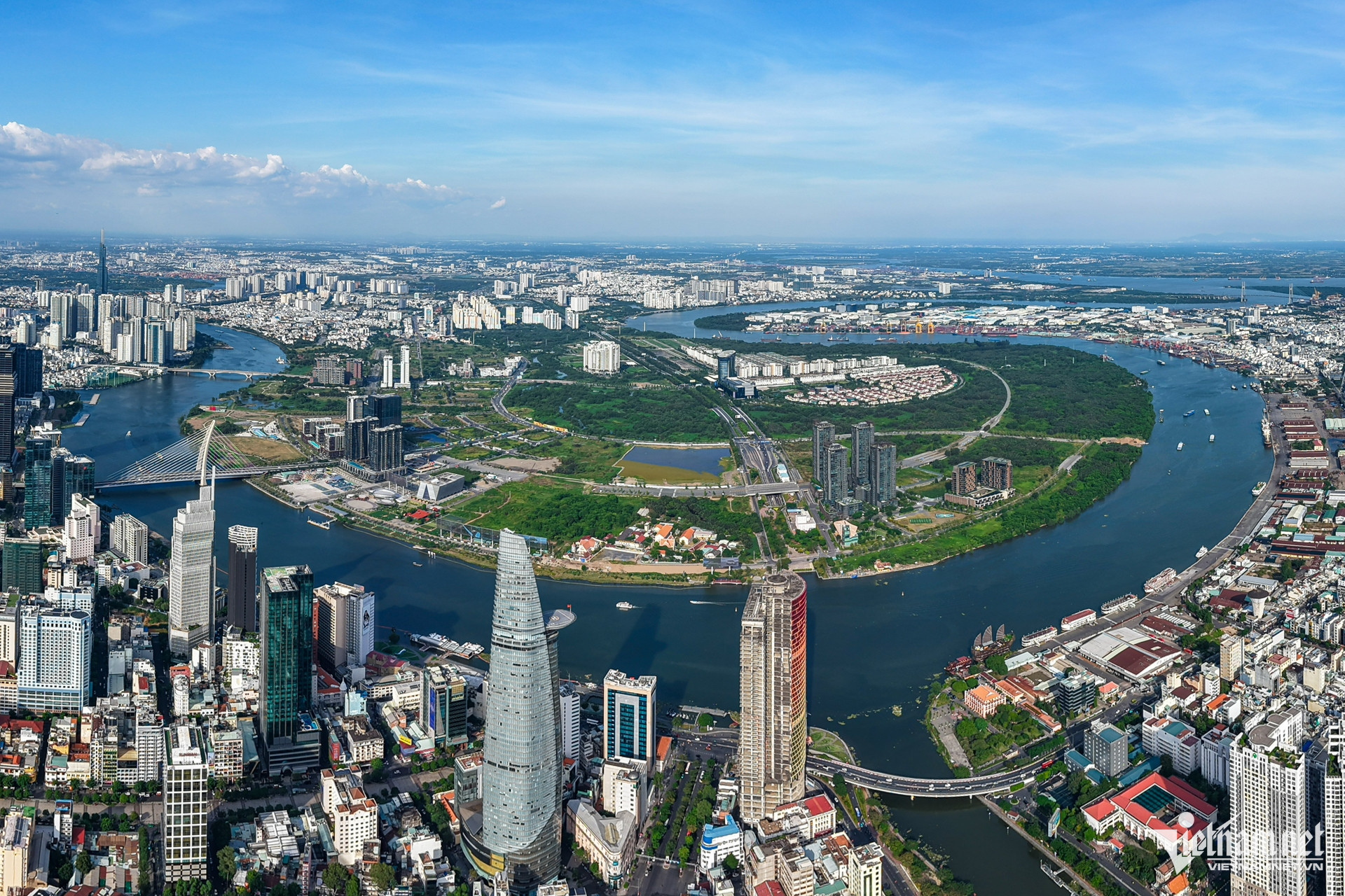
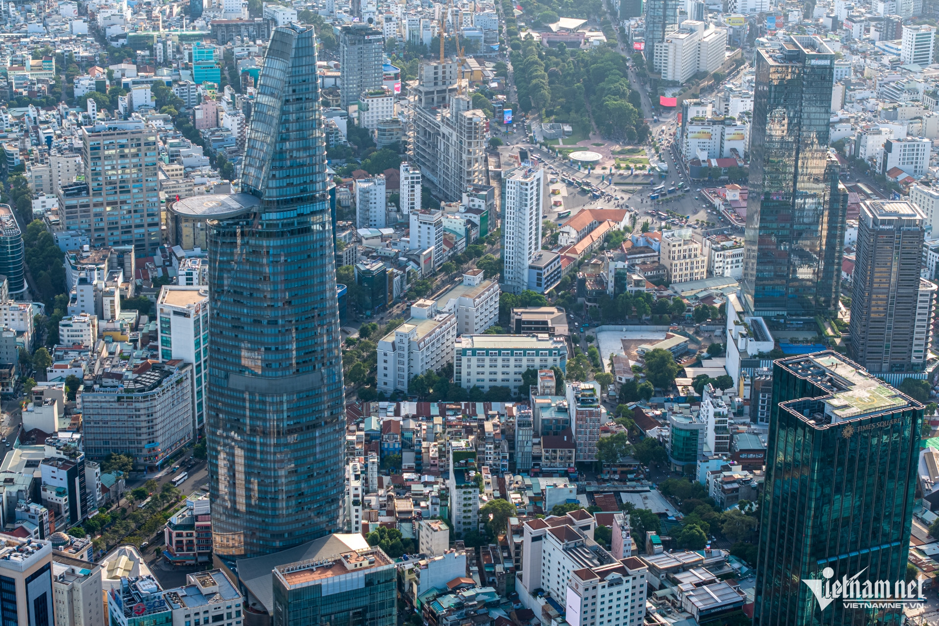
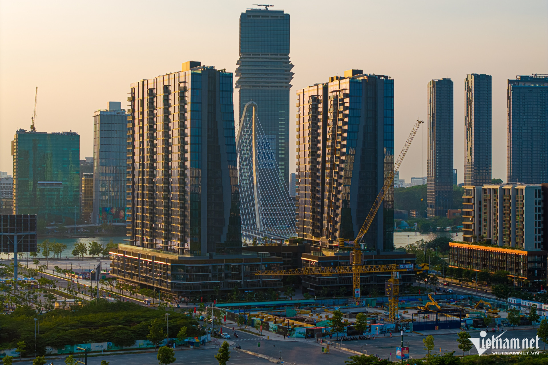
From a city rooted in history, Ho Chi Minh City is rapidly evolving into a regional hub of finance, technology, and innovation in Southeast Asia. Viewed from above, a skyline of towering buildings and modern icons lines the banks of the Saigon River.
Thanks to swift urbanization and strategic investment policies, the city continues to assert its position as Vietnam’s economic powerhouse, leading the way into a new era of prosperity and development.
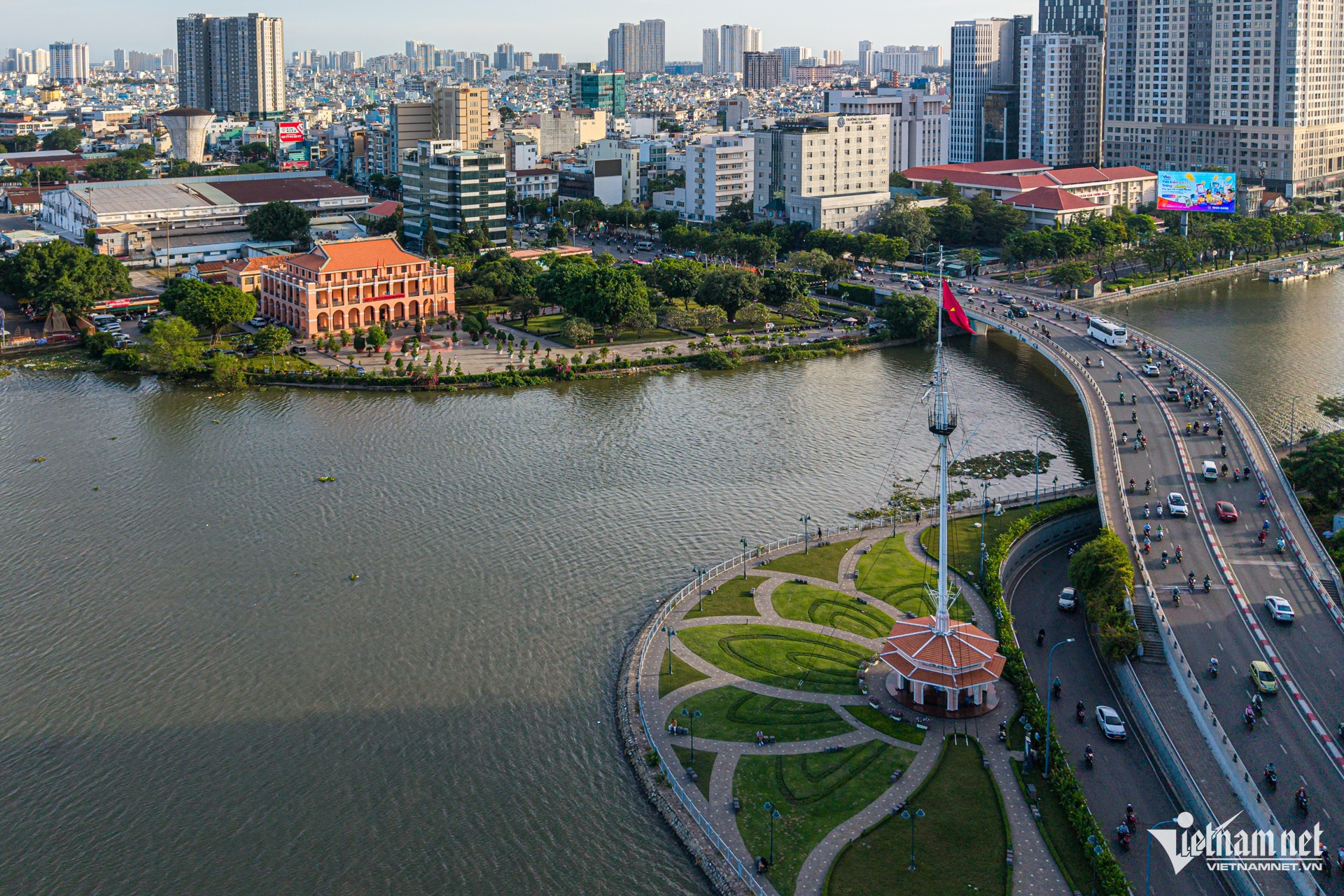
Me Linh Square in District 1 is known as the “heart” of the western Saigon riverside. It is a convergence point for six major roads: Ton Duc Thang, Ngo Duc Ke, Ho Huan Nghiep, Phan Van Dat, Hai Ba Trung, and Thi Sach. The central roundabout, surrounded by office buildings and luxury hotels, features a man-made pond and a statue of national hero Tran Hung Dao.
Skyscrapers and smart urban areas are shaping a youthful and modern cityscape.
Sala Urban Area, the first luxury residential zone in Thu Thiem (Thu Duc City), is notable for its expansive green parks and synchronized amenities. It contributes to the city’s vision of sustainable development, blending nature with modernity.
Phu My Hung (District 7) was Vietnam’s first model urban area. Today, it is a southern economic hub with financial, commercial, industrial, educational, and service facilities. The area includes Crescent Lake, inspired by Singapore’s Marina Bay, serving as a community focal point that harmonizes with South Saigon's broader urban landscape.
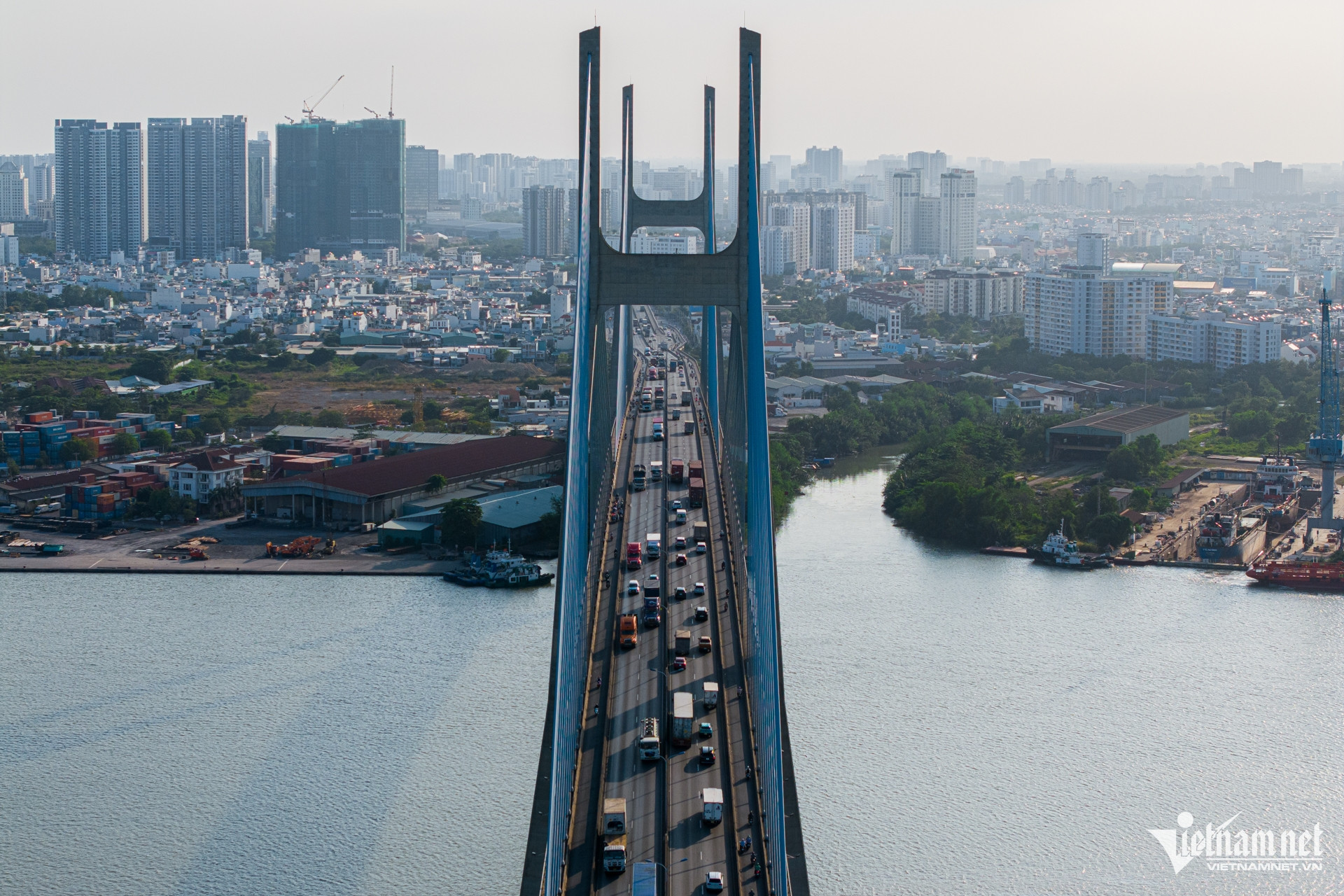
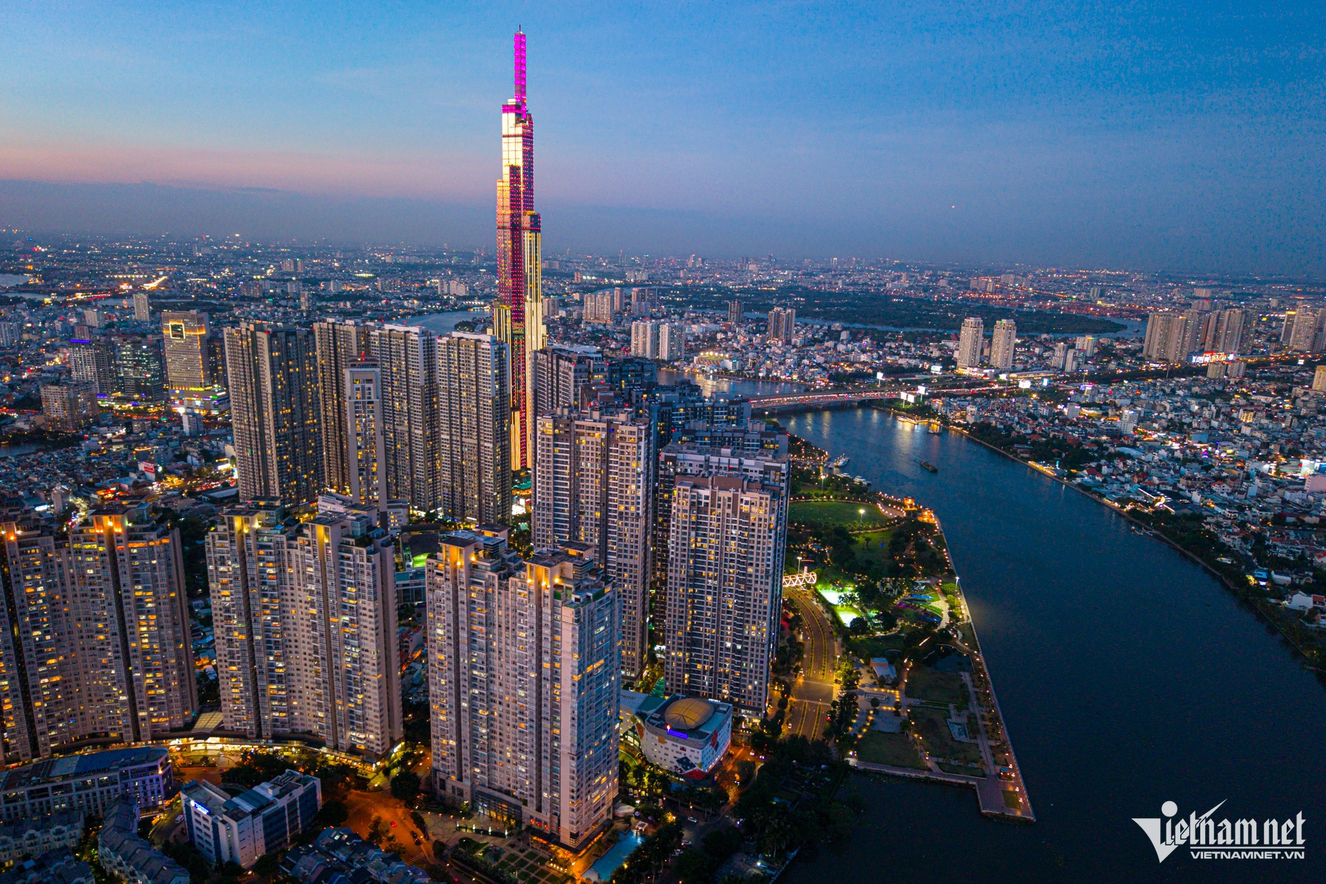
Ho Chi Minh City's diverse transportation infrastructure includes roads, waterways, and metro rail. The Phu My Bridge, the city’s largest cable-stayed bridge, connects District 7 to Thu Duc City and stands prominently over the Saigon River.
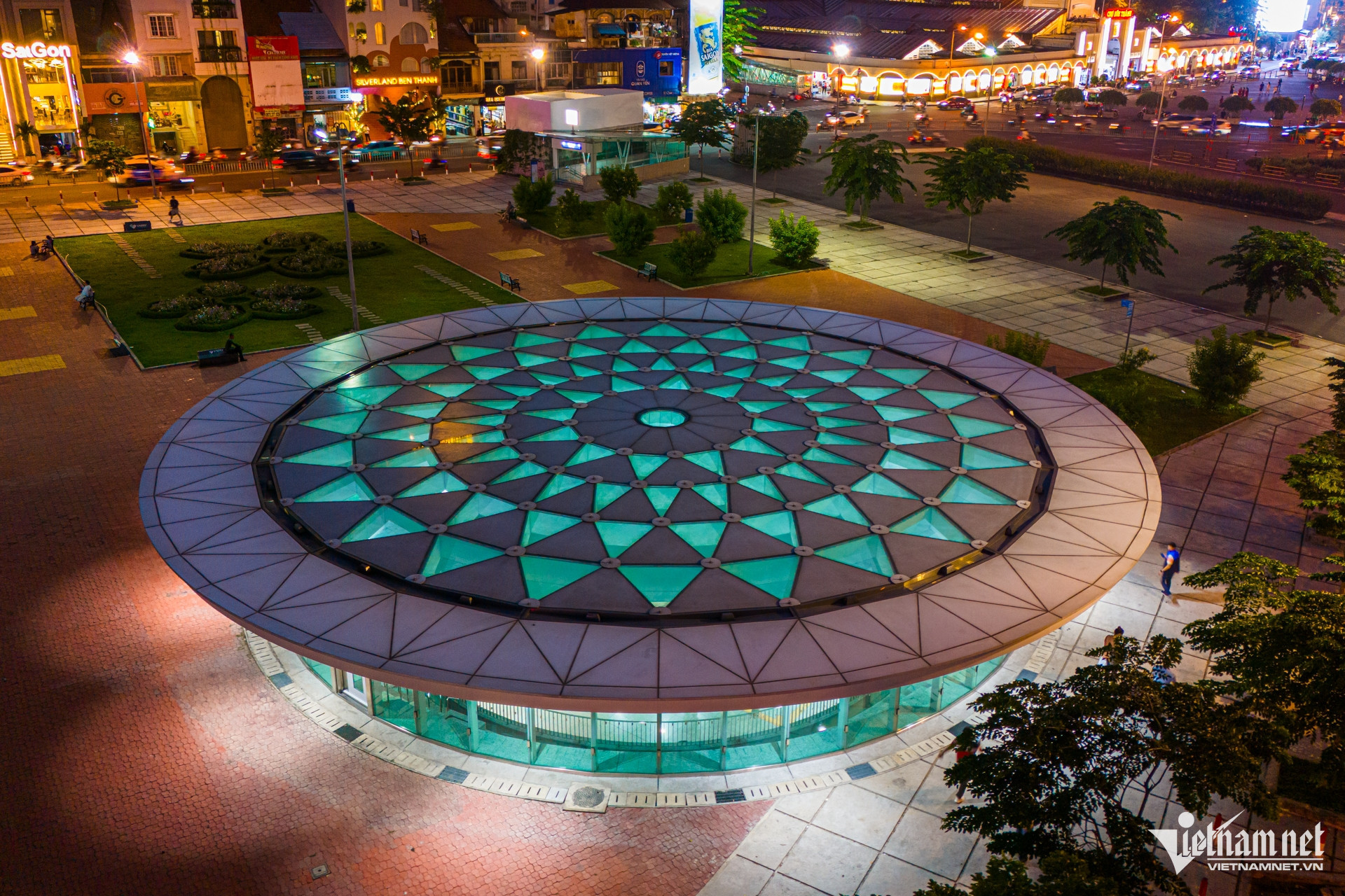
The city's Metro Line No. 1, Ben Thanh - Suoi Tien, officially launched in late 2024. With an investment of around 43.7 trillion VND (approximately 1.76 billion USD), the 19.7 km line includes 3 underground and 11 elevated stations, linking downtown District 1 to the city’s eastern regions. It signals a new milestone for Ho Chi Minh City's transport infrastructure, bringing the dream of a modern, green, and efficient public transport system closer to reality.
The Nhieu Loc - Thi Nghe Canal, nearly 10 km long, runs through Districts 1, 3, Binh Thanh, Phu Nhuan, and Tan Binh before emptying into the Saigon River. In 1993, the city began a major renovation project, building Hoang Sa and Truong Sa roads along the canal with an investment of more than 8.6 trillion VND (about 347 million USD). The project included relocating nearly 7,000 households, dredging 1.1 million cubic meters of sediment, constructing 16 km of embankments, installing 9 km of sewer pipes, reinforcing bridges, and installing high-capacity pumps and roads along the canal.
Today, the revitalized green canal has become an urban highlight, improving both the environment and the cityscape.
Over the past 50 years, from a city emerging from the wreckage of war, Ho Chi Minh City has risen to become a leading economic center. With its skyline of modern skyscrapers, it continues to live up to its legacy as the “Pearl of the Far East.”
From a city steeped in historical legacy, Ho Chi Minh City is steadily transforming into a financial, technological, and creative hub of Southeast Asia. Viewed from above, a skyline of towering modern buildings rises impressively along the Saigon River.
With rapid urbanization and well-structured investment policies, the city continues to affirm its role as the country’s economic powerhouse - ready to take the lead into a new era of dynamic growth, prosperity, and development.

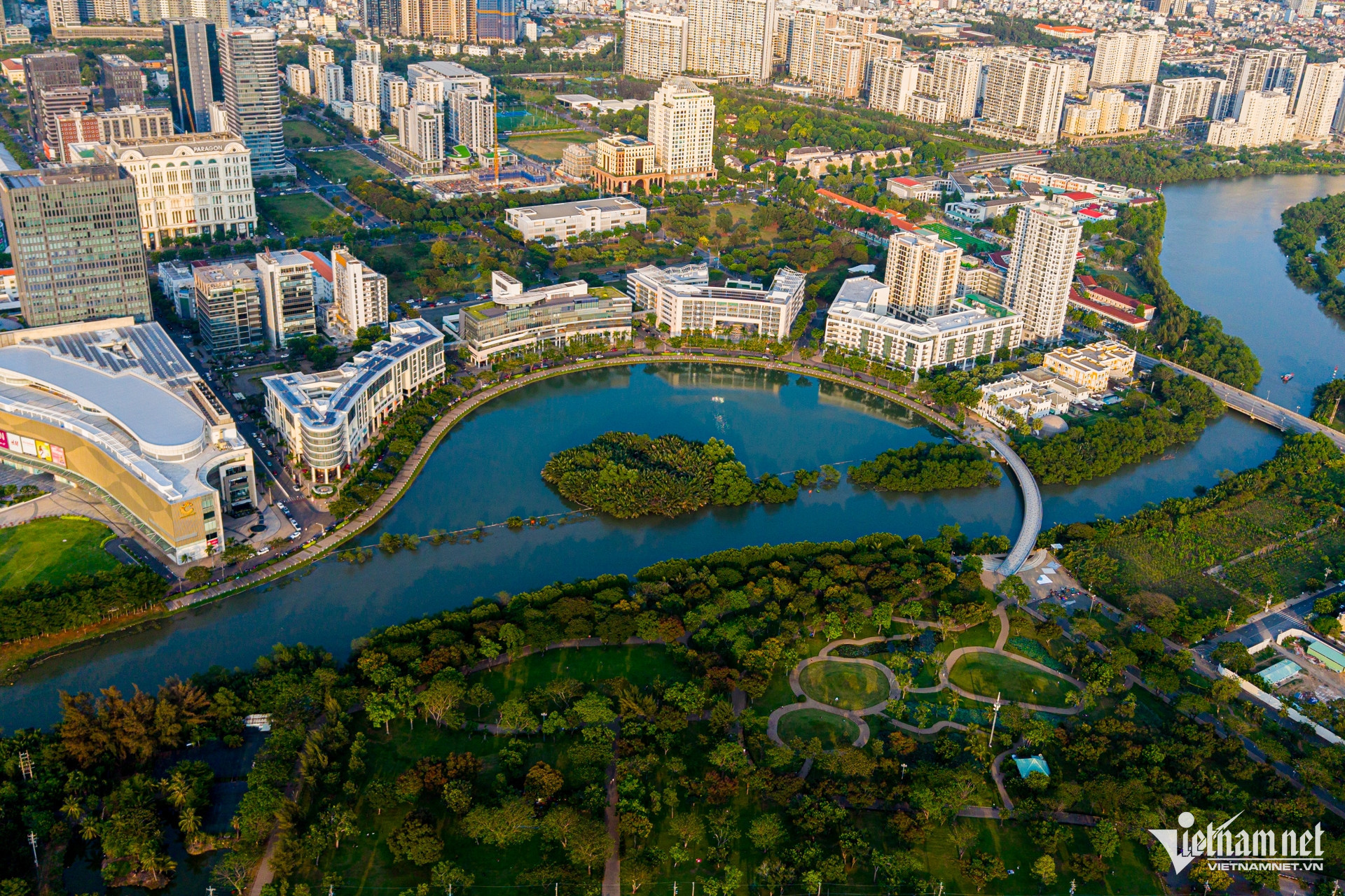
Phu My Hung Urban Area (District 7) is the first model urban development in the country. Today, it has evolved into a financial, commercial, service, industrial, and educational center in the southern part of Ho Chi Minh City.
In the image, Crescent Lake — designed to resemble Singapore Bay — serves as the "community heart," connecting and harmonizing with the entirety of South Saigon’s urban landscape.

A diverse transportation system - from roadways and waterways to urban rail - continues to shape the identity of the city named after President Ho Chi Minh.
In the photo, Phu My Bridge - the largest cable-stayed bridge in Ho Chi Minh City - stands out prominently over the green waters, connecting District 7 with Thu Duc City.
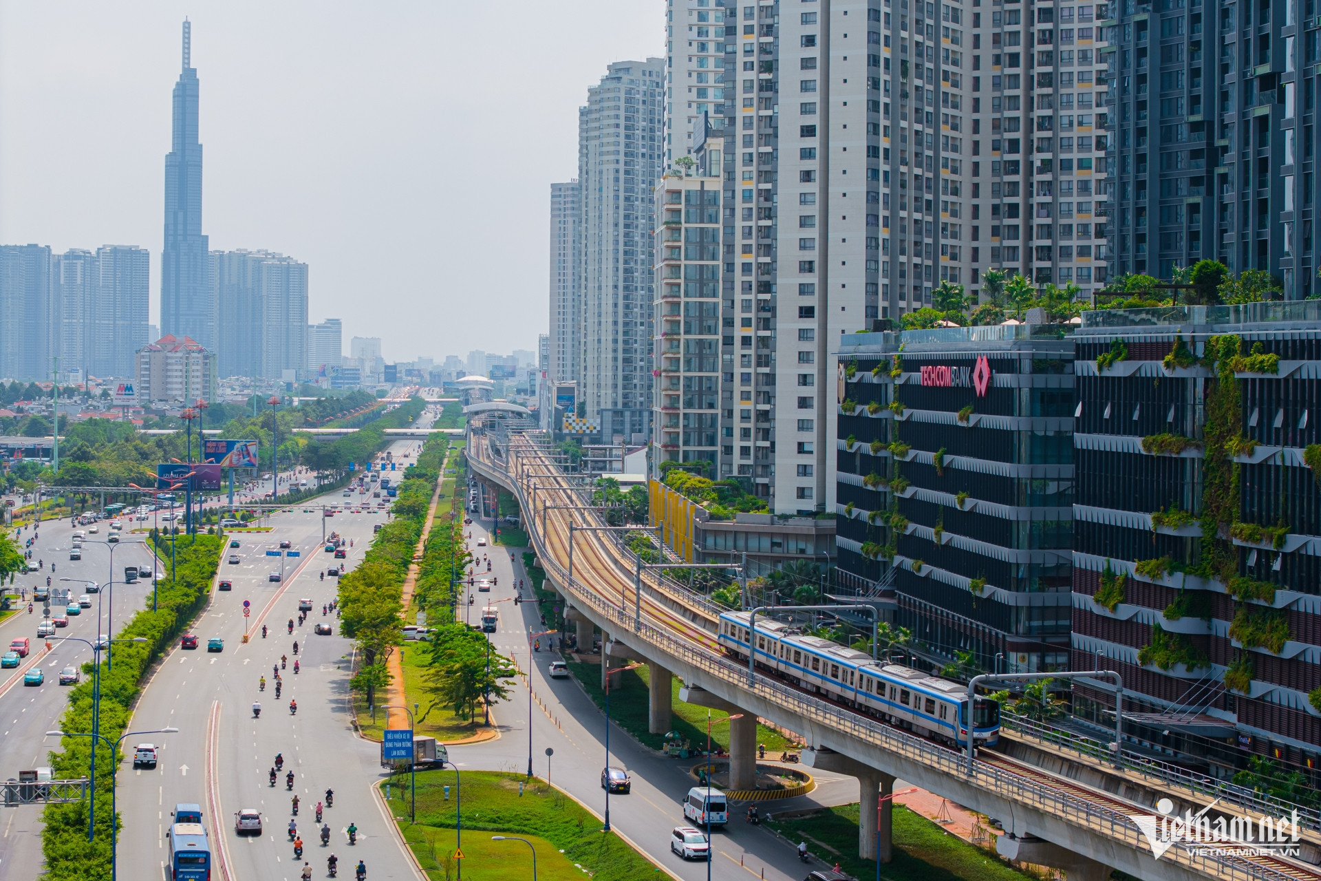
The Ben Thanh – Suoi Tien Metro Line No. 1 officially began operation at the end of 2024, marking a new milestone in Ho Chi Minh City’s transportation infrastructure. With a total investment of approximately VND 43,700 billion, the 19.7 km line includes 3 underground stations and 11 elevated stations, connecting the city center in District 1 to the eastern areas of the city.
The vision of a civilized, modern city with a high-quality, green public transportation system and abundant urban amenities is gradually becoming a reality.
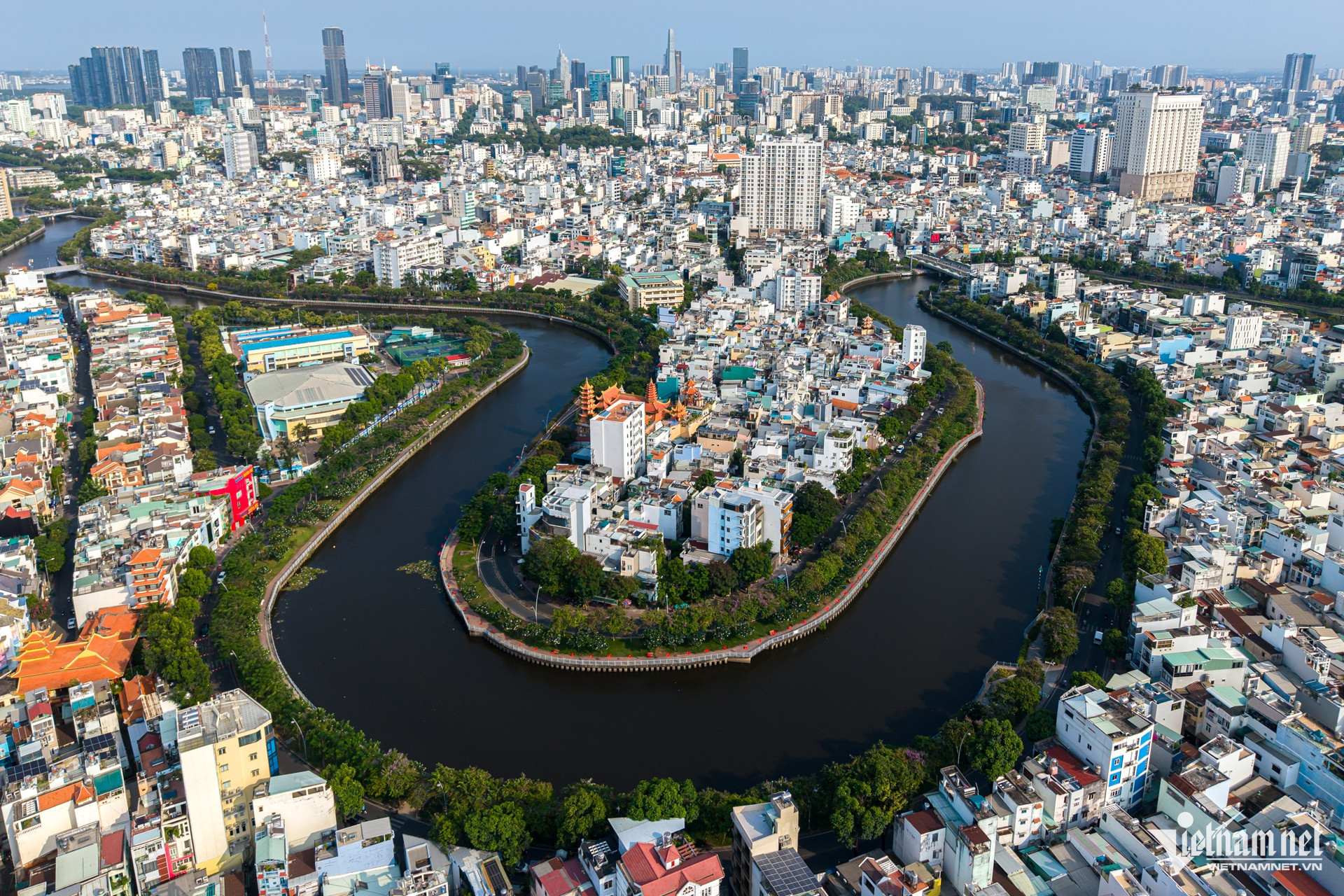
The Nhieu Loc – Thi Nghe Canal, nearly 10 km long, flows through Districts 1, 3, Binh Thanh, Phu Nhuan, and Tan Binh before emptying into the Saigon River.
In 1993, Ho Chi Minh City began a major renovation project of the canal, which included constructing two parallel roads - Hoang Sa and Truong Sa 0 with a total investment of over VND 8,600 billion. As part of the project, thousands of makeshift homes were cleared, and nearly 7,000 households were resettled. Approximately 1.1 million cubic meters of sediment were dredged, nearly 16 km of embankments were installed, 9 km of interceptor sewers were built, bridges were reinforced, high-capacity pumps were installed, and roads were developed on both sides.
Today, the revitalized green canal winding through the inner city not only serves as an urban highlight but also improves the environment and enhances cityscape aesthetics.
Nguyen Hue